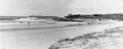
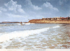
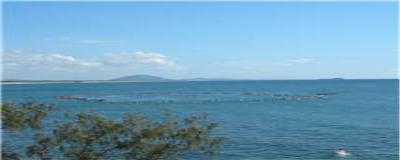
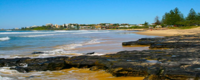
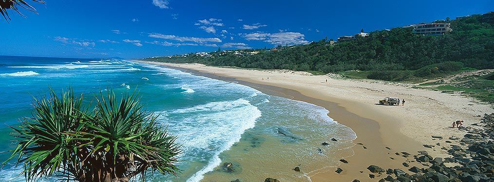
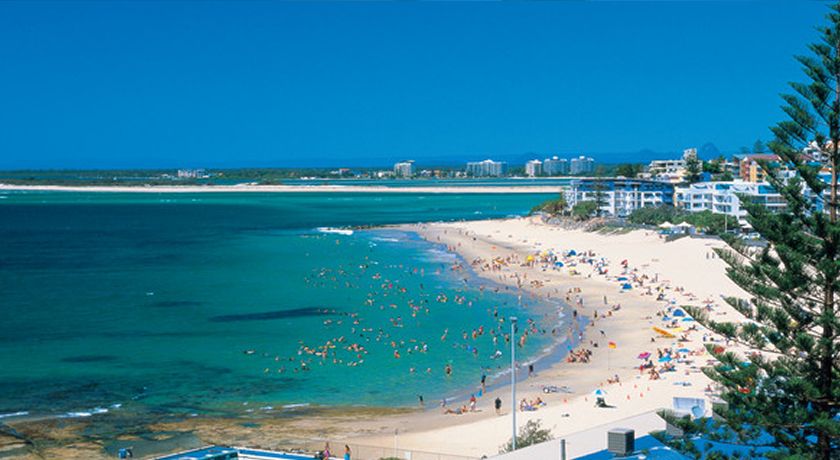
Showing posts with label Surfing. Show all posts

Saturday, 1 December 2018

Surfari Saturday - Peregian Beach

Surf Peregian


Now obviously I am no surfing expert, unlike most of the blokes we hang out with, but still had to mention Peregian Beach for its beautiful surf on the right day.....make sure you google a surfcam before committing to the drive.

Having said that, if you get there and it's all over, there are miles of cool shops and cafes to eat, drink and be merry - make sure you take the coastal road back and explore!
Related image
Image courtesy of Commercialview.com.au


Wednesday, 28 November 2018

Wednesday Walkies - Noosa National Park

Wednesday Walkies - Noosa National Park


It would be remiss of me to not include this famous walk featured on our beautiful Sunshine Coast.

Most of the locals are fully aware of it, but if we don't actually live at Noosa, we can forget it exists! Unless you surf of course ha!

I have attached a really good link (click on the picture).

Now as long as you don't mind seeing a few "nudie-rudies" on your way (along with a few sad little peeping toms), and as long as you don't mind seeing Koalas, Dolphins and bronzed gods on their boards, you can probably cope with this stunning walk!


Noosa National Park
Image Courtesy Of Sunshinecoast.com

Saturday, 24 November 2018

Surfari Saturdays - Moffat Beach, Caloundra

Surfari Saturday - Moffat Beach

Interesting waves but check out this surf spot on Surfspot ha! Their site is a font of knowledge....  Heaps of cool little shops for the bored females, too (those not cutting fully sick out the back)!


Image result for moffat beach surf

Saturday, 17 November 2018

Surfari Saturdays! Double Island Point

Surf Spot Double Island Point

This one is off the beaten track (about 2 hours at the top of our region), but if you like 4WD day trips, camping, fishing or surfing, this spot is for you! Probably not for the faint-hearted as it's pretty wild and secluded, but for those who know what they are doing, great spot!

There is a surf school for learners too.

Related image
Image Courtesy of Darren Tierney Galllery where you can purchase online!

Wednesday, 14 November 2018

Wednesday Walkies! Point Cartwright Lighthouse

For those who love exploring the region on foot, this is a lovely walk to the lighthouse at Point Cartwright...

Park at La Balsa park (maybe an esky for a picnic upon your return would be a treat), and walk through the park to the road that takes you along the rock wall.

Toward the end of the rock wall you can go up the grassy knoll (I know, stop it!) or take the end path to the secret beach and explore the rock pools....

For the more adventurous, you can pick your way around the foot of the cliff, hit the main Cartwright Beach, and then just take the steps back up that lead you adjacent to where you parked in the first place.

I believe the beach is dog-friendly, but the signs will tell you to leash, or not to leash. 

And of course, the anglers will have a rod handy for the rock wall!

Sometimes we forget what we have at our fingertips!
Image result for Images Point Cartwright lighthouse
Image courtesy of Sunshine Coast Daily

Friday, 9 November 2018

Maroochydore - Did You Know?


 There are a number of possible explanations for Maroochydore. All are based around the black swans which can be seen in the area. Some interpretations explain that the word is an English equivalent of the local Aboriginal word "marutchi" meaning "black swan" or "marutchi dora" meaning "water where the black swan lives". Alternatively the word possibly comes from the Yuggera language, "muru-kutchi" meaning red-bill, the name of the black swan. The Yuggera people lived around Brisbane. The name was given to the area by Andrew Petrie in 1842. Petrie was accompanied by two Yuggera men from whom, presumably, he obtained the name. The name Maroochydore came into general use in 1884.Related image

*Prior to the arrival of Europeans the area along the coast near Maroochydore was home to the Gubi Gubi Aboriginal people. 

* The first European in the area was the Irish convict John Graham who, having been sentenced to seven years transportation for stealing hemp, was sent to Moreton Bay. In July 1826, believing he could row to China, Graham escaped from Moreton Bay. He walked into an Aboriginal camp near the present site of Maroochydore and was immediately accepted as the ghost of one woman's dead husband. Graham lived with the Aborigines for six years.

* In 1833 Graham returned to Moreton Bay and gave himself up.

* Timber-getters were in the area by the early 1850s. They cut timber in the hinterland.

* A depot handling timber was established on the river by 1856.

* The explorer Andrew Petrie passed through the area in 1862 and named the Maroochy River.

* A wharf was built at the mouth of the Maroochy River in 1868.

* In 1888 the Salvation Army held a camp at Cotton Tree.

* William Pettigrew opened a sawmill on the Maroochy River in 1891.

* The Pettigrew sawmill closed in 1898.

* The township of Maroochydore came into existence in 1900.

* In 1907 Thomas O'Connor subdivided land near the river mouth and sold allotments.

 * The Club Hotel was built in 1911.

* A School of Arts and the local Surf Life Saving Club were both operating by 1916.

* A State Primary School was opened in 1921.

* The Maroochy Post Office opened in 1922.

* During the 1920s the Maroochydore Picture Palace and Jazzland was opened.

* A road from the Bruce Highway was opened in 1928.

* The local golf course was opened in 1956.

* It wasn't until the 1960s that the area developed as a major tourist destination.

* The local population doubled between 1961 and 1971.

* The canals at Maroochy Waters were built in the 1970s and 1980s.

Related image
Artists Impression of The New CBD with an interesting article in News.Com
* The Sunshine Plaza was opened in 1995.

NB:Information copied directly from the Aussie Towns site which contains other amazing links for exploration!

Saturday, 3 November 2018

Alexandra Headland - Did You Know?

The following information and images have been directly copied from the Alexandra Headland Community Association. Click on the name to take you to their full site, as the amount of work and research that this committee put into their community is second to none - always looking for more supporters!

The early history and the current life of Alexandra Headland is intimately bound up with the history of its neighboring suburbs and the two rivers it sits between – Maroochy and Mooloolah. The beach has always been one of the areas “richest assets” whilst its green belt is the only coastal forest remnant between the two rivers. Achieving the balance between development as a seaside resort, and protection of the natural environment has always been an issue – then and today.

The First Headlanders

The first inhabitants of this area are generally acknowledged to have been the Undanbi people – small family groups of aborigines who occupied these coastal plains. Distinguished by language and cultural traditions, they had cordial relations with other neighbouring groups with whom they shared a common language or dialect. No direct references can be found to an aboriginal name for this area or rocky headland, but the first built house was named “Wongothin” after the beach (and “wonga” means pigeon in Kabi Kabi dialect) and the surrounding property was named “Coolaluthin”, after the aboriginal word for cypress pines. The influence of aboriginal culture is preserved in the names for the rivers of Maroochy (black swan) and Mooloolah (black snakes – ‘mullu’ & fishing nets – mula).

Exploring Sailors

Captain Cook sailed past our coastline on May 17th 1770 in the Endeavour and a commemorative cairn was erected on top of Alexandra Headland in the bicentennial year  of his visit 1970.    In 1802 Matthew Flinders sailed past on an expedition to chart the coastline of New Holland in The Investigator.  Neither explorer came ashore to discover the beauty of the region.
exploring sailors 1 exploring sailors 2

1820-1840    Undanbi People Rescue Castaways

During 1823-24, three shipwrecked convict timbergetters were befriended and assisted by the Undanbi peoples of Mooloolah and Maroochy Rivers and they learned some of their language – a fast spoken dialect of the Turrubul language group. Other escaped convicts from Moreton Bay also lived for many years with many tribes.  Leichardt described them as “generally taller, slimmer people than the inlanders” and others noticed that they could be distinguished by the large callous on their wrists which developed as a result of manipulating their fishing nets. In the 1830s-1840s it was estimated some 80 Undanbi lived at Maroochy River with another group of similar size on the lower Mooloolah River.

1840-1860  Timber Exploration & Conservation Legislation.

Andrew Petrie explored the coastline in 1838 and 1840 asessing the economic potential for timber and he named Maroochydore. The Bunya Proclamation of 1842 (early conservation legislation) recognised the importance to aboriginal people of the Bunya Pine Trees, and created a reserve that included Alex to protect the area from timber felling and grazing. Ludwig Leichardt, naturalist and explorer, also described and crossed both the Mooloolah & Maroochy rivers in 1844.

1860-1880: First Land Sales and Timber Industry Established

In 1862 it was Tom Petrie (son of Andrew) who was one of the first to venture into Maroochy to exploit timber resources in 1862, and who is acknowledged to have had a great understanding of the aborigines.
But it was William Pettigrew, a friend of the Petrie family, who was able on August 4th 1864 to purchase a 330 acre property of lands and forests to use as his base for a saw mill. Portion 2 of this, some eighty acres, encompassed Alexandra Headland (and the beach he called Wongothin) were purchased for 124 pounds. Pettigrew also owned a fleet of steam and sailing ships. Pettigrew built the first house on Alexandra Headland in 1869 on high ground on the sheltered north side of the headland on land he named Coolaluthin and from where he could survey much of the land he owned. He also established a small farm and experimented growing sugarcane.
Helen Gregory reports that it was not until the influx of white settlers in the 1870’s that aborigines were forced to retreat from their traditional lands and food sources, and access to sacred places were denied. Traditional Aboriginal ways of life, kinship & religions systems began to collapse in the areas near the river where new settlers began to change the land and it natural productivity.
In 1871 Pettigrew moved a house from Mooloolah to the headland for his overseer and named it “Wongotha”. The esplanade along the beach became a traffic route to the timber mill from Maroochy River and the Alex area was fenced as a paddock for the bullocks who hauled the cedar, beech and she-pine logs. A small store opened between the two houses to supply the basic needs of timbergetters and early settlers.
1860 to 1880 1 1860 to 1880 2

1880-1900:  Settlement Named “Potts Point”

When John Potts took on the Pettigrew overseer’s job from 1880 – 90,  the land around the Headland quickly came to be known as Potts Point. By the end of the century, Pettigrew’s business interests were severely affected by the depression and the Banks foreclosed on his lands.
1880 - 1900
Images courtesy of Sunshine Coast Libraries

1900-1910:  O’Connor Purchases Pettigrew Land

Thomas O’Connor, a surveyor, purchased all of Pettigrew’s land on the coastal plain in 1903 including all of the area he would later name Alexandra Headland. The land parcel included land from Okinja to Pacific Terrace, including the land now known as Alex Forest. Hinterland residents were increasingly visiting for camping holidays and fishing trips. All the houses on the Headland were burned in a bush fire but demand for re-building was strong! Mooloolah Cemetery established on land at corner of Pacific Terrace and Alexandra Parade.
1900 - 1910 11900 - 1910 2
Images courtesy of Sunshine Coast Libraries


1910-1920: Coming Seaside City Renamed Alexandra Headland

Despite WWI, there was increasing demand for relaxation, so land owner and developer Tommy O’Connor subdivided the first allotments in Alexandra Headland in 1915 to develop a seaside resort (Mary St to Lindsay St and Janet St to Pacific Terrace) followed by allotments along the ocean front and Buderim Road . At this time O’Connor renamed the area Alexandra Headland in honour of the beautiful 70yr old  Queen Alexandra (the Queen Mother). Nambour Chronicle describes the “resurrection” of this seaside bay when the first houses were built on lots 68 & 69 , replacing houses that had been burnt down eight years earlier. It hoped for a “coming seaside city”! But not all his developments were welcomed and his plans for a larger hotel on Buderim Avenue were defeated in 1916. The desire to protect scenic places against the thrust of tourist development persists to this day.
In 1917, a boat and tram service operated to Nambour and Alexandra Headland could boast boarding houses and holiday homes.
1910 20 21910 20 3
Images courtesy of Sunshine Coast Libraries


1920-1930: Community Development – Beach and Surfing Activities

The end of the war sparked a boom in holiday villages and Woombye residents built a number of red-roofed seaside cottages on Alex Headland, and then founded the family orientated Alexandra Headland Surf Life Saving Club in 1924. Built by volunteers, mostly from Woombye, it seemed appropriate to adopt the Woombye Rugby League colours of a black stripe and gold background which symbolises a black snake and the golden wattle.  It took them only one year to win the champion club title which they held from 1925-1927.
O’Connor completes a vision for the first fully integrated resort complex on the Maroochy coast – and built a magnificent hostel on 36 acres opposite the Surf Club.  As a business it was affected by poor transport,and his failure to obtain a liquor licence and the Great Depression of 1929 put paid to this enterprise.
Many community groups arise – the Maroochydore Progress Association in 1920 and in 1924, Buderim identity Vince Crosby was the President of the Mooloolaba & Alexandra Headlands Progress Association.
The improvement of the coastal road is attributed to the Progress Association who built the first gravel road between the rivers in 1922 after the Council prioritised other agricultural roads. At times however the sand drifts near Alex Surf Club made the road over the headland impassable and people had to frequently travel via Buderim!
In 1927, the Brisbane Courier described the beaches of this area as a “seaside trinity of great beauty”.  Large heavy wooden surfboards appeared on the beaches – even Mum’s old ironing board occasionally got an outing!
1920 30 11920 30 21920 30 3
Images courtesy of Sunshine Coast Libraries


1930-1940:  Camping Heaven Beside the Beach

Alexandra Headland remained a place for relaxation – camping in public areas along the beachfront was common despite few public facilities.   The Presbyterian Church Youth Camps staff began to consider Alexandra Hostel as a future campsite and negotiations to purchase the land began.
By this time, most of the aboriginal people of the area had been sent to Cherbourg Mission – many miles inland far from their cultural homelands by the river and sea. There seemed to be no place for them in the changing Maroochy landscape.
1930 40
Images courtesy of Sunshine Coast Libraries

1940-1950:  WWII and Public Facilities Developed

The recognition of the beaches as the Shire’s richest assets resulted in some funding for public facilities for those who camped, as well as changing sheds and toilets.
Members of the Voluntary Defence Force mounted patrols on the headland. The US Army commandeered part of the Alexandra Hostel for soldiers R & R. A section of the Australian Army also occupied the building and built a large coop to house carrier pigeons in the grounds.  The 22nd Battalion camped by the beach in grounds now known as Trotter Park.
Fred Murray writes:’In 1946 only a gravel road extended through Alexandra Headland to Mooloolaba. Alexandra Headland contained about half a dozen houses, mostly facing Alice Street and the Esplanade. The only house south of here was Such’s home in Mary Street, only 30 yards from my own home.’
The Presbyterian Church under the guidance of Norman Nelson, the Director of Christian Education and Youth Welfare, purchased the hostel and Alexandra Park a total of 173 acres from the O’Connor estate, extending from the beachfront to Cathedral Hill in 1945. Church camps are conducted on the property continuously to present time.
A Mr A.J. Frost, who owned a clothing business in Nambour, had purchased a large parcel of land bounded by Mary Street, Buderim/Mool Rd and  and in 1948 he subdivided this into 34 allotments and developed local roads.
1940 50 11940 50 2
Images courtesy of Sunshine Coast Libraries


1950-1960: Tourism Focus & Cyclone Damage

Big support for the tourism industryled by Shire Chairman Low, who with great fanfare 1952 opened a modern caravan park at Alexandra Headland on the beachfront.  This closed off Alexandra Parades direct link from Alex Beach to Maroochydore Beach. It was the first council sponsored caravan park in Queensland and Australia – and celebrated with the planting of some 40 pine trees.
A Presbyterian church was erected in Edward Street, and a land selling spree by the church in 1958 included the top of Cathedral Hill through to Okinja Road.
There was much discussion on linking the three coastal townships of Maroochydore, Alexandra Headland and Mooloolaba. The gravel road was still under control of the Shire, but the ambitious Nicklin Government wanted to build a coastal highway.  In 1958 Maroochy Shire introduced a development plan with regulations to cope with future development of coastal areas.
Perhaps it was the damage created by the cyclonic weather of 1954, 55 & 56 with resulting erosion that led to concern for natural environment again conflicting with large development plans. Whilst the Mooloolaba Alexandra Headland Progress Association worked throughout early 50’s and lobbied Council for modern urban amenities like street names, signs, public phone box, street lighting, and a water tower.
In 1958 a large event was the Wheelbarrow Race from Alex to Mooloolaba Surf Clubs, and Alex had its own Badminton Association.
1950 60 11950 60 2
Images courtesy of Sunshine Coast Libraries


1960-1970: Population Surge in the optimistic 60’s

Queensland Government established a Beach Protection Authority in 1967 in response to a sand mining debate and resistance to building on dunes.  In Alex, further sub-divisions occurred on McClintock land (Mooloolaba/Buderim Rd, Alexandra Parade and Edward Street) and the Thynee estate (Mary St, Juan St, Alex Pde).  Mrs Betts-Ann Coates developed  “the only sophisticated restaurant and accommodation complex on the Sunshine Coast” when the Boolarong Restaurant and Motel opened in 1967.  It remained for many years an iconic meeting place in Alex.  The new holiday apartment building on this site is called Grand Palais.

1960 70 1 1960 70 2


1970-1980:  Dune Protection and Four Lane Roads are Issues –

The formation of the Uniting Church led to changes to the largest parcel of land in Alex.  It was subdivided into two separate but adjoining titles. The Uniting Church land containing Alexandra Hostel (later known as Alexandra House – it was the old youth conference centre located directly opposite the Alex Surf Club) was finally subdivided and a significant parcel sold.  In its place the Alex Shores Resort, and the Alex Shores Estate were developed.  The second half of the title remained with the Presbyterian Church,
There was considerable debate locally and in the shire as to what type of building (and  height) should be allowed on land near the fragile beaches, and how to protect the dune systems.  In January 1976, large waves from Cyclone David eroded coastline in front of Boolarong.  1000 sandbags and rocks were used to stabilize the area. Still strong enthusiasm for the potential of the tourism industry and camping still allowed on beachfront land north of The Surf Club.  The decade closed in great controversy as discussions on traffic solutions in Maroochy Shire including “demaining” and a “four lanes controversy”.
1970 80 1 1970 80 2

1980-1990: More road & environmental concerns

Amidst much controversy about leaks and plans, Alexandra Parade was upgraded to four lanes in 1980 when many wished for the funding to be allocated to bypass roads (like the Motorway which was finally opened in 1990 as a Toll Road).   The Uniting Church attempted to sell land but some local opposition. High rise development continues in Alex. Much debate about whether a separate Council to look after coastal interests required, as many felt higher coastal rates were subsiding inland areas.
Rising environmental consciousness leads to studies on environmental impact being required for all large developments.   Many new high rise developments north of The Surf Club.
1980 90 11980 90 2
Images courtesy of Sunshine Coast Libraries


1990-2000: Development vs Preservation

The Uniting Church land containing the old youth conference centre (directly opposite the Alex Surf Club) and the “Alex Forest” bushland was finally subdivided and sold, and in its place the Alex Shores Resort, and the Alex Shores Estate were developed.
In 1995 the Presybterian Church also sold part of their land for the “Tranquil Place” subdivision – not without great opposition from those determined to protect Alex’s remnant forest. The Maroochy Shire was convinced to purchase 3.58 hectares, and a result of this campaign “the Shire conservation levy” was introduced to facilitate the future purchase of Shire bushland with conservation value. A further 2.5 hectares were purchased from the Presbyterian Church by Maroochy Shire Council for preservation in 2000.
Commercial sponsorship comes to lifesaving in the form of “Iron Man” competitions.  The Mooloolaba Triathalon begins in 1993 and develops into one of Australia’s premier athletic events, with cyclists and runners pounding Alexandra Parade.
1990 2000 11990 2000 2
Images courtesy of Sunshine Coast Libraries


2000-2010: Real Estate Boom and Traffic Issues

The rise of the house prices in the triangle reflected the increasingly sophisticated homes being built and renovated throughout this small suburb. The old church on Edward St was replaced by units.  The first property in Alex to care exclusively for the elderly was opened – RSL Tantula Rise is a great addition to the community.
Traffic through Alex becomes a central issue. Although the opening of the Sunshine Motorway many years previously (1990) took some pressure off the coastal road, increasingly the road through Alex was seen as a “thoroughfare” – and the atmosphere of a people friendly Alex degraded. The opening of Maroochy Boulevard relieved some pressure, but when the State Government Coast Connect project suggested six lanes along the beachfront, the people reacted. The” No Six Lanes” campaign was very effective but proposals for bus advantage lanes are still to be resolved.   No other beachfront road has four lanes, and all are at 50kph or less.  Why Alex?
2000 10 1 2000 10 2 2000 10 3
After a colourful renovation and expansion, people power forced the Alex Surf Club to re-think another proposal for further expansion of the club at a site on the western side of Alexandra Parade – backing into Alex Shores residential estate.
The decade was coloured by some significant public events. Large crowds watched the sinking of the ex-HMAS Brisbane on 31 July 2005; the surfers farewell to Steve Irwin in September 2006; and then a great welcome home to lone adventurer/sailor Jessica Watson on 6 June 2010.

2010-2020  Strength in Community

A community association in Alexandra Headland is re-established and a website for the community of Alexandra Headland is launched.  Increasing environmental concerns about the stability of the dunes, a coastal walkway and how best to protect our beaches and natural environment.

References:

Alcorn, Berenis: A Rising Seaside Resort. Alexandra Headlands – A Historical Study , 1998.
Fink, Fred: History of Maroochydore-Mooloolaba, 1992.
Gregory, Helen:  Making Maroochy.  A history of the land, the shire, the people. Brisbane 1998
Hooper, Martin: Seachange for Elizabeth & William Hooper.  Vic 2008
Murray, Fred & Whittington, Dot:  Surveying my Life: An autobiography.  Nambour 2007
Nelson NF MBE, To Help Them Find Their Feet, Sith & Paterson, Brisbane 1966
Tainton Rev Joseph, Marutchi – the Early History of the Sunshine Coast, Unpublished 1976

Acknowledgements:  We thank the following for their helpful assistance

Photographs:  We wish to acknowledge the Sunshine Coast Libraries and Julanne Neal & Carol Hawley of the Sunshine Coast Heritage Library who assisted us in providing most of the photos for this historial site.  They maintain an excellent resource that is available to all – Picture Sunshine Coast
We also welcome photographs from members of the community, and hope this historial resource can be improved.

Friday, 2 November 2018

Coolum - Did You Know? By Astute Alexandra Headland

 Astute Alexandra Headland


Coolum - Did You Know?


The name is derived from the local Undumbi word gulum or guloom, meaning "blunt" or "headless", referring to the shape of Mount Coolum, which has no peak. [2] According to Aboriginal legend, Ninderry knocked off Coolum's head and it fell into the ocean and is now Mudjimba Island.
The Coolum district was the traditional land of the Inabara or Yinneburra clan of the Undanbi Tribe. In turn, they were part of the larger group of the Kabi Kabi. 

In 1823, the first Europeans to pass through Coolum were castaways and shipwrecked sailors. The first land selection in Coolum was made in 1871 by Grainger Ward - a pastoral lease of 255 hectares. Here, Ward ran upwards of 300 head of cattle. In 1881, Mark Blasdall selected his own lease of 252 hectares. Blasdall was the first to plan sugarcane in the area and to cut timber. He built two huts and a sawmill as well as clearing Coolum Creek, thus enabling steampships to enter to load timber and deliver supplies. By 1882 the steampships 'Tadorna Radjah' and 'Gneering' began to regularly travel from Brisbane to Coolum creek. In 1883 the first Coolum land was freehold and by 1884, Blasdall was declared insolvent and his land freeholded.

Image result for Coolum
Image Courtesy Of Coolum Beach Real Estate


The first permanent settler of Coolum was William Perry-Keene and his family in 1905. His home was called "Green Hills" and was situated at the corner of Beach Road, Daytona and Key West Avenues. Between 1906 and 1912 many people settled permanently in the region. By 1912 there were eight to 12 families living in the district. In 1909, Coulsin established a mailboat service on the Maroochy River. This provided the first regular connection between Coolum and the railhead at Yandina. In 1911, a horse-drawn tramline and punt loading facilities were built at Coolum Creek. 


Construction of the first paved road to Coolum was undertaken between 1922 and 1925. This provided vehicle access from Coolum to Yandina. In 1923, the tramline to Coolum was opened and unscheduled passenger services began. Over this time considerable expansion of the sugarcane industry took place. Cane farming provided the main source of financial stability in the district until the advent of tourism in the 1960s.

The Coolum Library opened in 1989 with a major refurbishment in 1997.[3]
 
In 2002 Coolum hosted the Commonwealth Heads of Government Meeting, replacing the 2001 meeting that was postponed and moved from Brisbane in the wake of the September 11 attacks

In 2006 Australian census, the population of Coolum was 7,744.

Tuesday, 23 October 2018

Marcoola - Did You Know?

Marcoola, a coastal suburb in Maroochy Shire, is 100 km north of Brisbane. It is positioned between Mudjimba and Mount Coolum, and includes the Sunshine Coast airport. Its name, dating from the 1960s, was formed by combining the first part of Maroochy with a slightly altered 'Coolum'.

Marcoola's urban area began around the surf life-saving club, a coastal housing strip between the beach and David Low Way. In 1971 the Surfair high-rise apartment tower (the first on Sunshine Coast) was built on David Low Way. Said by some to be 20 years ahead of its time, it turned only moderate profits and building maintenance was neglected. Its fame came from some notable rock concerts in the 1980s, the noise competing with air-craft take-offs.
Image result for marcoola beach
Image Courtesy of Marcoola Beach Resort


By the early 2000s Marcoola was identified as having some of the last remaining absolute beachfront sites. Its turn had come. The Atlantic resort opened in 2000, a much larger Marcoola Beach resort was opened in 2003 and Surfair was comprehensively refurbished in 2003-04 (over 220 rooms, apartments, penthouses). A Stockland housing estate has a projected 450 houses and 200 apartments.


The Surfair Central Tower is an iconic part of the Sunshine Coast.  Built in 1971, the tourism focal point was originally to be a part of the ‘City of Suncoast’ development of the sixties.  the tower stands today surrounded by similar buildings as a part of the Ramada Hotel.

The Surfair Tavern has been around nearly as long entertaining generations of Sunshine Coast locals and tourists.  Its proximity to the beach is unrivalled and over the years many a good time was had on the Marcoola stretch at Surfair.

historyimage
Image Courtesy of Surfair Website


Information Directly via Wikepedia and the Queensland University Queensland Places website.

Monday, 22 October 2018

Mudjimba - Did You Know?

Mudjimba, a coastal urban area between Coolum Beach and Maroochydore is 100 km north of central Brisbane. It was named after Mudjimba Island, a well vegetated rocky islet about two km due east of Mudjimba.

The island is the subject of at least two Aboriginal legends. One involved two women making a home on the island, where there were midyim berry bushes. When only one of the women could be seen on the island, it became known as Old Woman Island. The same legend concerned the midyim berry bush - hence 'midyam' becoming altered to 'Mudjimba'. A second legend interpreted the island as being the head knocked off the top of a warrior, Coolum, which is represented as the flat-topped Mount Coolum about six km northwards.

Mudjimba was part of the coastal strip development northwards to Noosaville following the construction of the David Low Way coastal road in the early 1960s. It has an unbroken beach southwards to the mouth of the Maroochy River along with a surf life-saving club, a caravan park and a foreshore reserve. Twin Waters golf course separates the township from the neighbouring suburb of Pacific Paradise. Twin Waters was financed by the failed financial institution Tricontinental, and remained in its portfolio until sold to Lend Lease in 2003.

Mudjimba Beach on the Sunshine Coast of Qld. Lady Island lies about 1 Kl. off shore. I have walked this beach with my sister a few times since I have moved to Qld. It really is a beautiful beach.


In 2005 the suburb of Twin Waters was created, reducing Mudjimba's area by about half, leaving it with the part of Maroochy River Conservation Park north of Ocean Drive. The Mudjimba caravan park is inset in the north-east corner of the conservation park.

The failure of the Twin Waters/Tricontinental venture, however, appeared to be beneficent, as median house prices grew by 85% in Mudjimba during 1996-2001. Pacific Paradise's prices grew by just 18%. The Sunshine Coast airport is immediately north in Marcoola. 

Information sourced directly from the Queensland University website, Queensland Places

Wednesday, 17 October 2018

Peregian Beach - Did You Know?

Peregian Beach is a slender beachside township on the Sunshine Coast, 110 km north of central Brisbane and 10 km south of Noosa Heads. 

Peregian is an Aboriginal word for emu.

During World War II, Peregian Beach, Sunshine Beach and surrounding areas were used for artillery training. Current residents occasionally discover artillery shells and unexploded ordnance on their land. On making such discoveries, residents should call the Police who will arrange for inspection and, if required, safe disposal.

In the 2011 census, Peregian Beach had a population of 3,531 people.

In 2015, there was a competition for local residents to choose one of four pieces of artwork to decorate the concrete walls of the Peregian Beach Reservoir.[ The winning artwork was "Peregian Stand" by Peregian artist Colin Passmore which depicted a stand of melaleuca trees.

Image result for Peregian beach
Image courtesy of Wotif.
 

A short distance inland from Peregian Beach there are dunes and sandy swamp land. Originally a haven for coastal flora and wildlife, the area was little fitted for grazing or agriculture and was accessed by a few sandy tracks. In the late 1950s the State Government entered into a public / private sectors arrangement for tourist development of the Sunshine Coast, involving the building of a coastal road and generous provisions for coastal land subdivision. Alfred Grant Pty Ltd promoted the Peregian Beach development, which was taken over by T.M. Burke after the 1961 credit squeeze 
(Burke had also planned and promoted Sunshine Beach and Marcus Beach, immediately to the north).

Peregian Beach is both a resort and a retirement town. The Noosa/Lake Weyba National Park is immediately inland, and there is a foreshore reserve along the town's entire length. 

There are a shopping centre, a hotel and a caravan park near its midpoint. The Peregian Beach Community College (2002) is just beyond Peregian Beach's border with Weyba Downs. 

Information courtesy of Queensland Places and Wikepedia.

Sunday, 14 October 2018

Noosa and Noosaville - Did You Know?

Noosa Heads and the adjacent Noosaville are 120 km north of central Brisbane, on the south shore of Laguna Bay and the mouth of the Noosa River. Since the 1960s Noosa has boasted some of Australia's most expensive coastal real estate. Like Byron Bay in northern New South Wales it draws tourists all year round from the southern states and overseas, especially Europe.

The Noosa sand mass is similar to the great dune formations that constitute the Cooloola sand mass and off-shore islands including Moreton, Stradbroke and Fraser. Noosa is underlain by rock, which caused the retarding and settlement of coastal sand drift. The Noosa sand mass is partially separated from the mainland by Tin Can Bay, Noosa River and Lake Cootharaba. It is thought that the name was derived from an Aboriginal word describing shade, shadow or ghost. The Kabi tribe inhabited the region between Redcliffe in the south, the Noosa River mouth and Cooroy and Nambour to the south-west.

Image result for images of noosa little cove
Image Courtesy of Stay In Noosa
A Brisbane timber merchant, William Pettigrew, had explored the Maroochy district for timber harvesting, and in 1863 he inspected the Noosa River and its lakes. The first European settlement in the area was Elanda Point on Lake Cootharaba, from where logs were taken downstream to a wharf at Tewantin on the 'Nusa Harbour'. In 1870 a selector, Walter Hay, took up land on which the Tewantin township was surveyed (1870) and his land holdings included Hays Island (now Noosa Sound) and parts of Noosaville. Noosa village, consisting of allotments along both sides of Hastings Street, was surveyed in 1879, and most allotments were sold by 1885. Laguna House on Hastings Street was built in the late 1890s. A short walk north from Hastings Street brought visitors to the ocean beach. By about 1900 holiday makers from Brisbane and Gympie made their way beyond Tewantin, finding accommodation in Laguna House or Bayview (Hillcrest Guest House) in Noosa Drive. Neighbouring Noosaville was known as Gympie Terrace.


Fishing and swimming were excellent at Noosaville and Noosa Heads, and access was by boat from Tewantin, reached by car from the Cooroy railway station. The first Life Saving Club was established at Noosa in a tent in 1927. In 1929 a real estate developer, T.M. Burke, built bridges across Doonella Lake and Weyba Creek: holidaying motorists queued up to cross them. In return for building the bridges, T.M. Burke received 470 acres of land from the shire, but land sales languished.

In 1959 the T.M. Burke firm joined with the State Government in building the David Low coastal road which opened up Noosa Heads for visitors and tourists. (Burke's also developed the adjoining coastal suburbs of Sunshine Beach and Peregian Beach, again on land acquired in return for road building.)
Intermittent cyclonic conditions have changed the size of the beach, and beach erosion in 1967 prompted the placement of rock fill to protect beachfront properties. Wave turbulence coming back off the rocks further eroded the beach and natural sand replacement did not cover the rocks. Sand pumping was needed. Developers then looked inland, and in the 1970s Burke's proposed to re-engineer Hays Island as a canal estate. Residents of Tewantin and Noosa Heads were sensitive to loss of vegetation, erosion of the landscape and the prospect of high-rise buildings as they did not want Noosa to become another Gold Coast. The Noosa Parks Association (1962) succeeded after 30 years of agitation in having several parks and reserves permanently kept aside. Noosa Spit, the southern 'Noosa Head', missed being developed after a bitter debate. A second canal estate, west of Hays Island and in Noosaville, was proposed by Burke's in 1973. It had to be modified to a non-navigable lake system with an outlet weir, and was completed in the late 1980s.

Image result for Noosaville
Image Courtesy Of Visit Noosa


Hastings Street's urban design testifies to stubborn local resistance to over-ambitious developers. Purists may quibble, but in terms of resorts there is some truth in the tourist blurbs that Noosa 'combines a village and cosmopolitan atmosphere ... managing to maintain natural beauty, while growing as a tourist centre'. Restaurants of international standard and luxury apartments are within walking distance of both Noosa Spit and the 477 ha Noosa / Lake Weyba National Park (created 1930, expanded 1949). Lugana Lookout on the edge of the park offers an unexcelled view over Noosa inlet. Laguna House in Hastings Street was replaced by units and shops and finally by Sebel apartments (1999). Dining and self-contained, low-rise apartments expanded into Gympie Terrace, the esplanade beside the river in Noosaville.

Noosa Heads is tourist oriented and Noosaville houses much of the local workforce in conventional residential estates. However, it also includes the luxury Noosa Sound (1973) and Noosa Waters (1991) on the former Hays Island. Both have residential and resort accommodation. Noosaville has the Noosa private hospital (1999), the Good Shepherd Lutheran College (1986) and St Teresa's Catholic College (2004). The State primary school on Noosaville's western boundary was opened in 1996, sharing its catchment with Tewantin. Luxury shopping is in Hastings Street, and the Noosa Fair drive-in shopping is at Noosa Junction (1987), criticised at the time of its opening as a prime example of inappropriate design. In 2006 Noosa Civic Shopping Centre, three times as big as Noosa Fair, was opened in the south of Noosaville, adjoining an industrial area.

Information directly from Queensland Towns.

Tuesday, 9 October 2018

Sunshine Beach - Did You Know?

 The area south of Noosa Headlands was formerly known as Golden Beach but was rarely visited before the 1920s. In 1928, Thomas Marcus Burke gained land there in exchange for building roads and bridges from Tewantin. After World War II it was marketed by his son, Marcus, as Sunshine Beach.

Sunshine Beach and neighbouring Marcus Beach are on the Sunshine Coast, 115 km north of Brisbane and immediately south of Noosa Heads. Both are the product of successful real-estate developers, Alfred Grant Pty Ltd and TM Burke Pty Ltd, in the 1950s-60s.
Sunshine Beach is reached by David Low Way, a coastal road jointly financed by the State Government and the developers, the latter gaining generous subdivision approvals from the government and Noosa Shire.
Image result for sunshine beach
Image courtesy of Visit Noosa


Despite the suburb's proximity to the Noosa/Lake Weyba National Park, Sunshine Beach has been criticised for the lack of neighbourhood recreation space. It provides most of the educational facilities for Noosa - Sunshine Beach, State (1982) and Catholic (1990) primary schools and a high school (1992). There are also two churches, a campus of the University of the Sunshine Coast, a drive-in shopping centre and surf life-saving club.

Information courtesy of Wikepedia and Queensland Places

Saturday, 6 October 2018

Caloundra - Did You Know?


* A general store was opened in 1910. 

* The Caloundra area wasn't settled by Europeans until 1862. The first permanent settler was John Ballinger who selected land for sheep-raising south of Lake Currimundi.

* The town was surveyed in the 1870s.

* In 1875 the Brisbane newspaper proprietor and politician, Robert Bulcock, purchased 277 acres in the district.
 
* In 1882 the explorer William Landsborough, with a £2000 reward from the Queensland government, purchased 2,372 acres of what is now Golden Beach. Between 1882 and his death in 1886 Landsborough grazed sheep on his property.

* The first land sales in the town occurred in 1883.

* The first hotel in the area was built in 1885 on Shelly Beach.

* By the late 1880s Caloundra was becoming known as a seaside resort.

* The town's first school was opened in 1889.

* In 1896 Caloundra got its first lighthouse.

* By 1905 Wilson's Guest House was offering holidays on Dicky Beach.

* A bakery was built in 1909.

* In 1917 Robert Bulcock, Jr subdivided part of his land into 404 building blocks.Related image

* The local School of Arts was opened in 1927.

* Golden Beach was subdivided in 1928.

* The Kings Beach surf lifesaving club was formed in 1933.

* During World War II Caloundra became an important defence location with machine gun sites on the beaches and three radar stations.

* The population was 2,800 in 1961.

* The local high school was opened in 1967.

* Kawana Waters Shopping World was opened iin 1979.

* Major commuter belt development occurred during the mid-1980s.

* In 2008 Caloundra City was amalgamated with Maroochy and Noosa Shires to form the Sunshine Coast Regional Council.


 Information copied directly from the Aussie Towns site which contains other amazing links for exploration!


Tuesday, 2 October 2018

Rainbow Beach - Did You Know?

* The earliest inhabitants, the local Aborigines, were camping on Inskip Point, which they called Carah, up to 10,000 years ago.

* On 18 May, 1770 Captain Cook sailed past and named both Carlo Sand Blow and Double Island Point.

* The first Europeans to settle in the area in the early 1900s when timber cutters. There numbers were sufficient for a school to be established for their children. The need to ship the timber to Maryborough resulted in a lighthouse being built at Double Island Point and lighthouse keeper being employed to keep watch over the entrance to the Great Sandy Straits.

*  Zircon, ilmenite and rutile were mined on Inskip Point between 1965 and 1971 by Queensland Titanium Mines. They developed simple accommodation and access roads to the area.

* In 1967 a tourist ferry service was started between Tin Can Bay and the southern reaches of Fraser Island.

* Development of the area is so recent that Tin Can Bay wasn't officially gazetted until 1969 and that was only because of the local sand mining industry. It was around that time that the government built a road to Rainbow Beach.

* Sand mining in the area was relatively short-lived. It ceased in 1976.

Info copied directly from the Aussie Towns website


Sunshine Coast - Was 80s Mecca for Nightlife and Live Bands!

 There are no words for how good we had it!  Let's start with this video/pictures courtesy of the Sunshine Coast Daily/Courier Mail and ...