Showing posts with label Tourism. Show all posts

Sunday, 9 December 2018

Serenity Sundays - Buderim Falls

Sneaky Piece Of Paradise In Buderim


Unbeknownst to many, there is a beautiful little slice of heaven in the middle of Buderim, known as Buderim Forest Waterfall.
 

It sits within a 45 hectare park, and the boardwalk is wheelchair friendly (about 600m), if you have someone who would like a mini-fix of tranquility?

Click the image below to check out full details and directions!

Image result for buderim waterfall
Image courtesy of Visit Sunshine Coast

Friday, 7 December 2018

Foodie Friday - Juan Fifty

Mexican In Our Hood!


From the crew who brought us the Good Bar at Mooloolaba, we have a cool Mexican hangout at our fingertips!

Now this is no formal, stuffy restaurant where you sit around waiting to catch the waiters eye for a drink or to order, rather you can go up and order as you go.....this is a good idea for when you are not sure how full you will get (food or drinks ha), so you can sample, experiment etc. 

Image may contain: outdoor
Image From Juan Fifty Facebook Page


The most wonderful part is that when you go up to order, rather than the face like a dropped pie (or punched pillow) that we see far too much of these days, it seems to be the order of the day to give the customer a big smile, and make whatever cocktail or drink they order to perfection! Who'd a thunk that service and smiles might make a comeback??? Wow!

Image may contain: 2 people, people smiling, people standing
Evidence of smiling team from their Facebook page :)


The food is closer to traditional Mexican and pretty healthy frankly (not drowned in cheese and sour cream), although they make a subtle appearance. The ingredients are all freshly chopped, and seem to suit all levels of endurance when it comes to chilli or hot food.

 Image may contain: people sitting, table, food and indoor

The reason for this is their secret weapon - the wall of sauces! Make sure when you order that you do a 180 and check it out on the case behind you......this is serious chilli/sauce heaven, so you can add your own (or not if you can't hack it).

Image may contain: indoor
Wall Of Sauces - Image from Juan Fifty Facebook Page


The beer drinkers will also be pleasantly surprised by the prices - similar to surf/bowls club prices, which include some basic Aussie and also some great craft beers - hard to find both in the same spot for some reason - this way EVERYONE can enjoy a cold beer at the same place!

Get behind this one crew, we don't want to lose them and have to listen to ourselves whining about "where did it go"! Bel x

Wednesday, 5 December 2018

Wednesday Walkies - Mount Coolum

Mount Coolum Walking Track


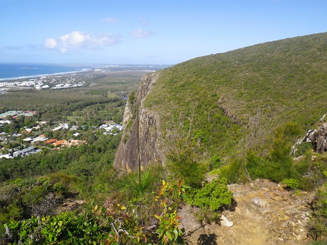
I've been avoiding this one, as much as I can say I have been avoiding all exercise at this level....this is an 800m track but feels like 8ks (to an asthmatic dumpling). I have friends who do this regularly, who will probably tell me I'm a sook, but the view is worth it, I know that much!

 
Catch your breath and take in the stunning 360 degree views stretching from Point Cartwright and the Glass House Mountains in the south, to the Blackhall Range in the west and Noosa Heads to the north. South and west from the summit, the park extends across flat lowlands cloaked in wallum, paperbark wetlands, eucalypt forests and rainforest remnants. This is one of the only places to see these plant communities on the Sunshine Coast.
Image result for images mount coolum walking track
Image Courtesy Of Aussie Bush Walking

Sunday, 2 December 2018

Serenity Sundays - The Mary Valley Scenic Drive And The Seven Steps To Serenity

Sunday Drivers Rejoice!


The details are on the link attached to the photos, but this is the most wonderful way to feel alive and a great reminder of what we have at our fingertips!

Image result for mary valley
Image Courtesy of the Australian (This would have been gone if the Traveston Dam had not been stopped)


My recipe for happiness on this adventure is:

1. Duck out and fill up the car using one of the petrol finder apps (otherwise there will be less serenity ha) - then "let it go"......

2. Pack up a picnic - folding chairs or a blanket are fine, but a marquis is handy depending on what you find. For the budget-minded make sure you pack a thermos or cold drinks, too. Towels and togs maybe? There are lots of creeks on this drive if you are fearless.

3. Put the starting point in your Bluetooth, or just wing it (more fun)

Related image
Image Courtesy Of Stayz


4. Pack puppy too, if you have one, along with the lead and a water bowl, and treats for being good.

5. Commence drive at the top point (or bottom point if coming from the North), and then work your way back to home, ensuring you stop at every gorgeous spot until one just sucks you in for your picnic.


6. Remember to check out the produce stands when you come across them. Often organic and usually inexpensive - you may even encounter one of the old "honesty" boxes....

7. Wind the windows down and inhale the bush smell!

Sleep like a baby tonight - why? Because these sort of activities always get you thinking about what matters in life and what changes you need to make to become much happier - take the time on this trip to either chat with your other half about what matters, or give yourself the time to really focus.

Friday, 30 November 2018

Foodie Fridays - Fish On Parkyn

Foodie Fridays - Fish On Parkyn


What sort of person would not mention a long-term stayer in then fly by night restaurant game? Why are they still here? Because they offer beautiful fresh 5 sSar seafood dishes (with a few others for those who can't/don't eat seafood), 5 Star friendly service, a lovely open industrial space and wonderful cocktails.

Photo of Fish on Parkyn - Mooloolaba Queensland, Australia
Image Courtesy Of Yelp


If that's not enough and you are moaning after lunch/dinner, you can stroll next door to the Yacht Club and relax....or just straight over the road to the beach/tables at Mooloolaba spit!

This place is a credit to the owner, and I think the secret must be consistency!

Photo of Fish on Parkyn - Mooloolaba Queensland, Australia. Fish on Parkyn (white table linen) and Sakana sushi (foreground) under one roof
Image Courtesy Of Yelp

Thursday, 29 November 2018

Thursday Thursday - Theebine Hotel

Theebine Hotel

Well, we used to call this hidden gem "Petticoat Junction", as it has a little rarely used (if ever) railway track at the front of it, and is just beautiful. Not sure if it's heritage listed, but I sure just discovered that it is for sale! Eeeek! Wish I had a lazy 1.25 mil laying around!

No automatic alt text available.
Image courtesy of the Theebine Hotel Facebook Page


Now this place ticks all the boxes - pub grub, regular entertainment, rustic accommodation and a dinky-di bar at the front....what you are NOT prepared for though, is the giant entertainment area out the back with pool tables and a juke box where you can load it up and waste more money than a pokie once you've had a couple of cold beers....there is so much to this place, so probably smartest to visit their facebook page for a full picture of it.

No automatic alt text available.
Image Courtesy Of The Theebine Hotel Facebbok Page


Bonus thrill - nearby is the Dickabram Bridge - a heritage listed bridge built in 1885 (?) I believe you can still drive over it, and some dear friends and I made sure we WALKED over it to give it the full respect it deserves.....stunning with a picnic table nearby, but I am going to tag some true locals to give full commentary on this particular blog - too much good stuff to miss details!

Image result for dickabram bridge
Image courtesy of Wikipedia

Monday, 26 November 2018

Kenlworth - Did You Know?

History Of Kenilworth (Info Courtesy of Wikipedia)


The Mary River was known to the Aboriginals as the Numabulla and the name for the Kenilworth area being Hinka Booma. In 1842 Andrew Petrie named the river as the Wide Bay River. In 1847 that Governor Fitzroy renamed the river after his wife Mary.

Image Courtesy Of Qld.com

 Richard Joseph Smith tendered to set up the first cattle run on the east bank of the Mary River in 1850. At the time Mrs Smith was reading Sir Walter Scott's novel "Kenilworth" and she decided to name the property after the novel. The town was surveyed and split off Kenilworth Station in 1921 and took the name of the Station. During the second half of the 19th Century, the Smiths took up more land. 

Other settlers arrived in 1891 originally intending to grow small crops. There was a ready market at the goldfields in Gympie but after the floods of 1893, 1895 and 1898 had wiped out their crops, most ventured into dairying and pig breeding. In 1901 the Kenilworth Farmers' Association was formed and in 1907 they built the Kenilworth Farmers Assembly Hall. This later housed a library and hosted dances. In 1905 the Association was responsible for establishing a co-operative butter factory which opened in Caboolture in 1907. 

Also established was the Kenilworth Farmers' Co-operative Store in Eumundi. In 1912 a steam-powered sawmill was built on Coolabine Creek. In 1921 Kenilworth Station was sold off and divided into dairy farms and allotments. By 1925 all the large estates in the district had been subdivided and sold. Today dairying is still a major part of farming in the area but there has been diversification into fruit and vegetables and pig farming. 

Kenilworth Post Office opened by 1926 (a receiving office had been open from 1896).
 
The first store was opened in Kenilworth on 2 January 1924 as well as the new hall opening and the first butcher's shop appeared in 1925. Kenilworth Provisional School built by the community opened on 22 January 1900. This school became a State School on 1 January 1909. (This school was in the locality now known as Gheerulla).
 
Kenilworth Township was opened in the Kenilworth Hall on 21 October 1924. The hall, in 1926, was equipped to show silent pictures. The site for a public recreation ground was purchased in 1927 and in 1933, the Public Hall was moved to this new location. The Church of England Mary Valley Parish was established in 1925. 

The Kenilworth Library opened in 1986 with a major refurbishment in 2000.
At the 2006 census, Kenilworth had a population of 238.

yoghurt dairy mousse kenilworth cheese
Image Courtesy Of Kenilworth Dairies


Mystery Mondays - Majestic Theater Pomona

Mystery Mondays - Majestic Theater Pomona

Haunted or are its bones just still settling after 94 years.....you decide!

Article attached - click on image.

I remember a school excursion to this beautiful old lady to see a silent movie, and was in awe of the amazing atmosphere - highly recommend this as a day trip or you can stay overnight at the Pomona Pub if you are tough enough to "hack it" ha! I sure was a couple of years ago - love a country pub - the more basic the better - more adventurous!

Don't mind saying that real estate has gone crazy in some of these gorgeous sidings over the last few years either.


https://www.gympietimes.com.au/news/hunt-for-theatres-ghost/2510166/


Sunday, 25 November 2018

Serenity Sundays - Cooran Lookout

Cooran Lookout

This was always one of my favorite drives, and I always used to call it Cooran Mountain (possibly mistaken) but I know for sure it goes by James M McKane Memorial Lookout. 

If you are chasing serenity at the end of a gorgeous country drive (plus see a cute little township on your way), then check out the link above, which includes lots of juicy detail.

For god's sake don't forget to pack a picnic and take Rover - so much to see and sniff (for Rover not you)....there are picnic tables and loos if I remember - who knows, if you guys all leave now, you might run into each other - say hi from me!


Related image
Image Courtesy Cooran.com.au

Thursday, 22 November 2018

Thirsty Thursday - Secret Watering Holes - Ricks Garage Palmwoods

Ricks Garage Palmwoods

It may be the worst kept secret on the coast by now, but the first time we went there it was literally a cute lil' diner with a shop on the side and a garage out the back, with 2 very friendly people running it. 

It's now an example of what a small business can look like with some determination and local support, along with some real initiative and a feel for what people want.

The coast has had a real deficit of "real pubs" caused by bad decisions and bad taste, but this toxicity has not reached Palmwoods yet thank God!

Image may contain: sky and outdoor 

On any day you can enjoy scenes like the above, or classic cars, a classic bike rally, or just go upstairs to the "no kids zone" exclusive whiskey bar, where the service is A++++.


Having said that, if you have kids, they can run around on the grass downstairs screaming their little hearts out, so no discrimination here ha! There are far too many facets of this place to list here, so if you haven't been there, make it happen, and if you have, remember to go back - lots of times ha!

 Image may contain: sky, car and outdoor

Saturday, 17 November 2018

Surfari Saturdays! Double Island Point

Surf Spot Double Island Point

This one is off the beaten track (about 2 hours at the top of our region), but if you like 4WD day trips, camping, fishing or surfing, this spot is for you! Probably not for the faint-hearted as it's pretty wild and secluded, but for those who know what they are doing, great spot!

There is a surf school for learners too.

Related image
Image Courtesy of Darren Tierney Galllery where you can purchase online!

Thursday, 15 November 2018

Thirsty Thursday - Secret Watering Holes - Kin Kin Hotel

Kin Kin Hotel

Around half an hour North of Noosa, this little gem is a local best kept secret! It has it all from amazing old fashioned pub food to pool tables, darts and giant outdoor areas. It also boasts a number of traditional pub accommodation rooms for sleep overs and you can even camp in the adjacent oval for large groups.

The publican has no objection if once shut you take a couple of eskies onto the verandah either....just be a bit respectful.

https://www.visitnoosa.com.au/image/noosa-drive/countrylife-04.jpg

This is cool for a weekend away with friends, and has a legendary brekkie spot just over the road.

Pete is the well-ensconced publican and has a lovely nature.

Wednesday, 14 November 2018

Wednesday Walkies! Point Cartwright Lighthouse

For those who love exploring the region on foot, this is a lovely walk to the lighthouse at Point Cartwright...

Park at La Balsa park (maybe an esky for a picnic upon your return would be a treat), and walk through the park to the road that takes you along the rock wall.

Toward the end of the rock wall you can go up the grassy knoll (I know, stop it!) or take the end path to the secret beach and explore the rock pools....

For the more adventurous, you can pick your way around the foot of the cliff, hit the main Cartwright Beach, and then just take the steps back up that lead you adjacent to where you parked in the first place.

I believe the beach is dog-friendly, but the signs will tell you to leash, or not to leash. 

And of course, the anglers will have a rod handy for the rock wall!

Sometimes we forget what we have at our fingertips!
Image result for Images Point Cartwright lighthouse
Image courtesy of Sunshine Coast Daily

Sunday, 11 November 2018

Glasshouse Mountains - Did You Know?

Image result for glasshouse mountains
Image Courtesy of Aero Power Flight School

 * In his Journal on 17 May, 1770 Captain James Cook wrote: "These hills lie but a little way inland, and not far from each other: they are remarkable for the singular form of their elevation, which very much resembles a glass house, and for this reason I called them the Glass Houses …". This is a reference to their appearance which reminded him of the glass furnaces in Yorkshire.

 *The Glass House Mountains are a series of eleven intrusive volcanic plugs, formed of rhyolite and trachtyte, lavas which hardened inside the vents of tertiary volcanoes, about 25-27 million years ago. The cooling of the mountains resulted in the formation of vertical columns which can be observed on Mount Beerwah, Mount Ngungun and Mount Coonowrin.

*Mount Beerwah is the highest peak at 555 metres. Coochin (235 m), Coonowrin (377 m), Ngungun (253 m), Elimbah (129 m), Beerburrum (278 m), Tibberoowuccum (220 m), Tunbubudla (293 m and 312 m), Miketeebumulgrai (199 m) and Tibrogargan (364 m) all are located within the Glass House Mountains National Park and some offer excellent opportunities for bushwalking, abseiling and picnicking. 


 * The Glass House Mountains were formed approximately 25-27 million years ago.

* Prior to European settlement the area around the Glass House Mountains was occupied by people from the Gubbi Gubbi Aboriginal language group.

* On 17 May, 1770 Captain James Cook became the first European to sight the volcanic plugs.

* In July-August, 1799 Matthew Flinders sailed up the Queensland coast. He explored the area for sixteen days and climbed Mount Beerburrum.

* Today the volcanic plugs are part of the Queensland National Parks. The area around the mountains, because of the rich volcanic soil, produces pineapples, papaws, strawberries, avocados and passionfruit, as well as vegetables and macadamia nuts.

NB:Information copied directly from the Aussie Towns site which contains other amazing links for exploration!

Friday, 9 November 2018

Maroochydore - Did You Know?


 There are a number of possible explanations for Maroochydore. All are based around the black swans which can be seen in the area. Some interpretations explain that the word is an English equivalent of the local Aboriginal word "marutchi" meaning "black swan" or "marutchi dora" meaning "water where the black swan lives". Alternatively the word possibly comes from the Yuggera language, "muru-kutchi" meaning red-bill, the name of the black swan. The Yuggera people lived around Brisbane. The name was given to the area by Andrew Petrie in 1842. Petrie was accompanied by two Yuggera men from whom, presumably, he obtained the name. The name Maroochydore came into general use in 1884.Related image

*Prior to the arrival of Europeans the area along the coast near Maroochydore was home to the Gubi Gubi Aboriginal people. 

* The first European in the area was the Irish convict John Graham who, having been sentenced to seven years transportation for stealing hemp, was sent to Moreton Bay. In July 1826, believing he could row to China, Graham escaped from Moreton Bay. He walked into an Aboriginal camp near the present site of Maroochydore and was immediately accepted as the ghost of one woman's dead husband. Graham lived with the Aborigines for six years.

* In 1833 Graham returned to Moreton Bay and gave himself up.

* Timber-getters were in the area by the early 1850s. They cut timber in the hinterland.

* A depot handling timber was established on the river by 1856.

* The explorer Andrew Petrie passed through the area in 1862 and named the Maroochy River.

* A wharf was built at the mouth of the Maroochy River in 1868.

* In 1888 the Salvation Army held a camp at Cotton Tree.

* William Pettigrew opened a sawmill on the Maroochy River in 1891.

* The Pettigrew sawmill closed in 1898.

* The township of Maroochydore came into existence in 1900.

* In 1907 Thomas O'Connor subdivided land near the river mouth and sold allotments.

 * The Club Hotel was built in 1911.

* A School of Arts and the local Surf Life Saving Club were both operating by 1916.

* A State Primary School was opened in 1921.

* The Maroochy Post Office opened in 1922.

* During the 1920s the Maroochydore Picture Palace and Jazzland was opened.

* A road from the Bruce Highway was opened in 1928.

* The local golf course was opened in 1956.

* It wasn't until the 1960s that the area developed as a major tourist destination.

* The local population doubled between 1961 and 1971.

* The canals at Maroochy Waters were built in the 1970s and 1980s.

Related image
Artists Impression of The New CBD with an interesting article in News.Com
* The Sunshine Plaza was opened in 1995.

NB:Information copied directly from the Aussie Towns site which contains other amazing links for exploration!

Thursday, 8 November 2018

Maleny - Did You Know?


*There are two possible explanations for the naming of Maleny and both of them are spelling mistakes. One theory argues that it was named Maleny because the Balfour brothers, who established the Colinton Station in 1841, were surveyors and they named Malleny Mountain on the Blackall Range after the tiny Scottish town of Malleny. Alternatively it was named after a surveyor named Maloney who worked in the local area. Either way the spelling was pretty bad. It is either Maleny but should be Malleny or Maleny and it should be Maloney ... but never Maleny.

 Image result for maleny

* The area was once occupied by the Nalbo and Dallambara peoples of the Gubbi Gubbi nation who each year gathered at Baroon Pocket on the banks of the Obi Obi River to feast on Bunya nuts. The explorer Ludwig Leichhardt witnessed one of these gatherings and described it as "This plain they call Booroon ... seems the rendezvous for fights between the hostile tribes who come from near and far to enjoy the harvest of the Bunya". In fact it was an annual gathering of Aborigines from as far away as the Gold Coast and the Darling Downs.

* By the 1850s timber cutters had moved into the district and for the next few decades the primary industries were timber cutting and sawmilling. Not surprisingly when it came to naming Maleny's streets the timber industry was acknowledged with streets named Maple, Myrtle and Cedar. By the 1870s the district had a timber mill and a blacksmith.

* On 13 November, 1878 Isaac Burgess selected land on the present site of Maleny. It was the beginning of a period when dairy and beef cattle were grazed on the rich grasses which resulted from the substantial annual rainfall and the rich red volcanic soils.

* A school was opened in 1886 and a local post office in 1890. The town was officially proclaimed in 1891.

* Although dairy farming dominated the local economy (a butter factory was opened in in 1904 and a second factory in 1912) the area became increasingly focussed on mixed farming with small crops and orchards replacing the pasturelands.

* Maleny remained a rural service town until the 1980s when retirees, seeking a cool alternative to the coast, moved in and started building large houses on one and two acre lots. This evolved into the town becoming an arts and crafts centre with a dominant alternative lifestyle. Perhaps the best symbol of this alternative lifestyle was the town's passionate attempt to resist the arrival of a Woolworths supermarket in the early years of the twenty-first century.


NB:Information copied directly from the Aussie Towns site which contains other amazing links for exploration!

Wednesday, 7 November 2018

Nambour - Did You Know?

*The town that grew up in the area around 1870 was known as Petrie's Creek. It was renamed Nambour in 1891. The name, a local Aboriginal word (Naamba) meant red flowering tea-tree (Callistemon viminalis) or its bark. It had been the name given to the first cattle station in the district which had been selected by William Samwell in 1870.


 *Prior to the arrival of Europeans the area was occupied by people from the Gubbi Gubbi Aboriginal language group.
 
* The first settler in the area was Matthew Carroll who selected 40 ha in January 1870.

* Carroll was followed two months later by William Samwell who selected 658 ha which he called Nambour. And later in 1870 a third selection was made by Henry Hootan but it was forfeited in 1872.

* In 1884 Mathew Carroll opened the Tullababa Hotel

* In 1885 the Tullababa Hotel became a post office branch with Carroll as the postmaster. By this time two sawmills were operating in the area.

* In 1886 the Sylvannia School was opened.

* The town was officially subdivided in 1889.

* The railway reached the town in 1890 and was officially opened in 1891. 

*Blocks were subdivided & new settlers commenced clearing the land to grow fruit, sugarcane & farm produce.

* The Moreton Central Sugar Mill Company was formed in Nambour in 1894.

* A sugar mill was built in 1896.

* In 1913 the first town library was built.

* In 1917 the first rural school was built in Queensland.

* During 1924 17 buildings in the town were destroyed by fire.

* Electricity reached the town in 1927.

* October 1929 saw the Town Hall and Town Library destroyed by fire.

* By 1930 the town had its own hospital - the Maroochy District Hospital.

* By the 1960s the district had been renamed the Sunshine Coast.

* Cane was still cut by hand in the area as recently as the 1970s. This was only because of the hilly terrain which was not suitable for cane-cutting machines.

* In recent times the agricultural base of the area has expanded to include a variety of tropical crops - macadamia nuts, bananas, citrus fruits and pineapples.


NB:Information copied directly from the Aussie Towns site which contains other amazing links for exploration! Click on the "Underbelly" label for local legend and lore....

Tuesday, 6 November 2018

Yandina - Did You Know?

Image result for Yandina
Image Courtesy Of Sunshine Coast Property Group
*The local Aborigines, the Kabi Kabi, called the district around Yandina 'koongalba' meaning 'small water' and the early settlers named it Native Dog Flat. Eventually the town was named Yandina after the Yandina cattle run which was located east of Mount Ninderry. It is claimed that 'yandina' is a combination of two local Kabi Kabi words 'yan' meaning 'to go' and 'dinna' meaning 'feet' ie to go by foot.


* the district had been settled by the Kabi Kabi people for thousands of years prior to the arrival of Europeans.

* European settlers moved into the area in the 1850s and by 1870 the township of Yandina had been officially surveyed. The predominant industry, as with most of the Sunshine Coast hinterland, was timber with timber cutters logging bunya pine, cedar and beech from the forests.

* a church was built in 1880 and a hotel was opened in 1889. The hotel had to be moved when the railway arrived in 1891.

* Ginger growing had started in the Buderim area shortly after World War I. It was a crop of minor importance until World War II stopped importation from China allowing the industry to expand to meet local demand. The Buderim Ginger Grower’s Co-operative Association Limited, originally located in Buderim, was established by five local farmers. In 1979 it was moved to a much bigger factory in Yandina.

* In 1996 the town was bypassed by the Bruce Highway.


NB:Information copied directly from the Aussie Towns site which contains other amazing links for exploration! Click on the "Underbelly" label for local legend and lore....

Monday, 5 November 2018

Gympie - Did You Know?

* Prior to European settlement the district was occupied by the Gubbi Gubbi people.

* By the 1840s European graziers had established sheep properties in the area. John Daniel 
McTaggart established the Kilkivan selection 50 km west of Gympie around this time.

* In 1867 James Nash, the son of an English farm labourer who had migrated to Sydney in 1857, discovered gold near the Mary River. Nash announced his find on 16 October 1867 and it resulted in "one of the wildest rushes in Queensland history".

* By 1868 there were more than 25,000 people in the Gympie area.

* It was officially named Gympie in 1868. Previously it had been known as Gympie Creek.

* The first flood of the Mary River during European settlement occurred in 1870.

 Related image

* The town was proclaimed a municipality in 1880.

* The railway arrived in 1881 and in 1888 it had its own stock exchange.

* In 1891 the rail line connected Gympie to Brisbane.

* The town's worst flood was recorded in 1893 when the Mary River reached 25.45 metres.

* Gympie was officially declared a town in 1903.

* The gold mining eventually closed in 1925. By that time the city was an important regional centre for the surrounding rich agricultural district.

  
NB:Information copied directly from the Aussie Towns site which contains other amazing links for exploration!

Sunday, 4 November 2018

Tin Can Bay - Did You Know?


 *Although there is some dispute as to the meaning of the word it is widely accepted that Tin Can Bay's name is a variant of the local Aboriginal word 'tuncanbar' which may have referred to the dugongs which abound in the area. The word also may have meant a vine or the local mangroves.
Image result for Tin Can Bay
Image Courtesy Of Trip Advisor

 
* In the 1850s a dugong station was established at the mouth of the Kauri Creek, just north of Tin Can Bay, and dugong were killed and their oil extracted in much the same way whales were exploited at the time.

* A European settlement was established around 1870 primarily as a port to ship timber to the Maryborough sawmills. There was also some oyster cultivation.

* Although Norman Point is now a pleasant park and a jetty for the Coast Guard it was originally the site of one of Queensland's first railway lines. The railway was constructed to transport logs to the jetty where they were loaded onto barges and shipped to the mills in Maryborough.

* In 1922 township lots were sold and by the 1930s it had become a popular and cheap holiday destination used mostly by people who lived nearby in the hinterland.

* By 1957 Tin Can Bay had become a fishing village. There was a prawning fleet and by 1971 it had its own fish market.

NB:Information copied directly from the Aussie Towns site which contains other amazing links for exploration! Click on the "Underbelly" label for local legend and lore....

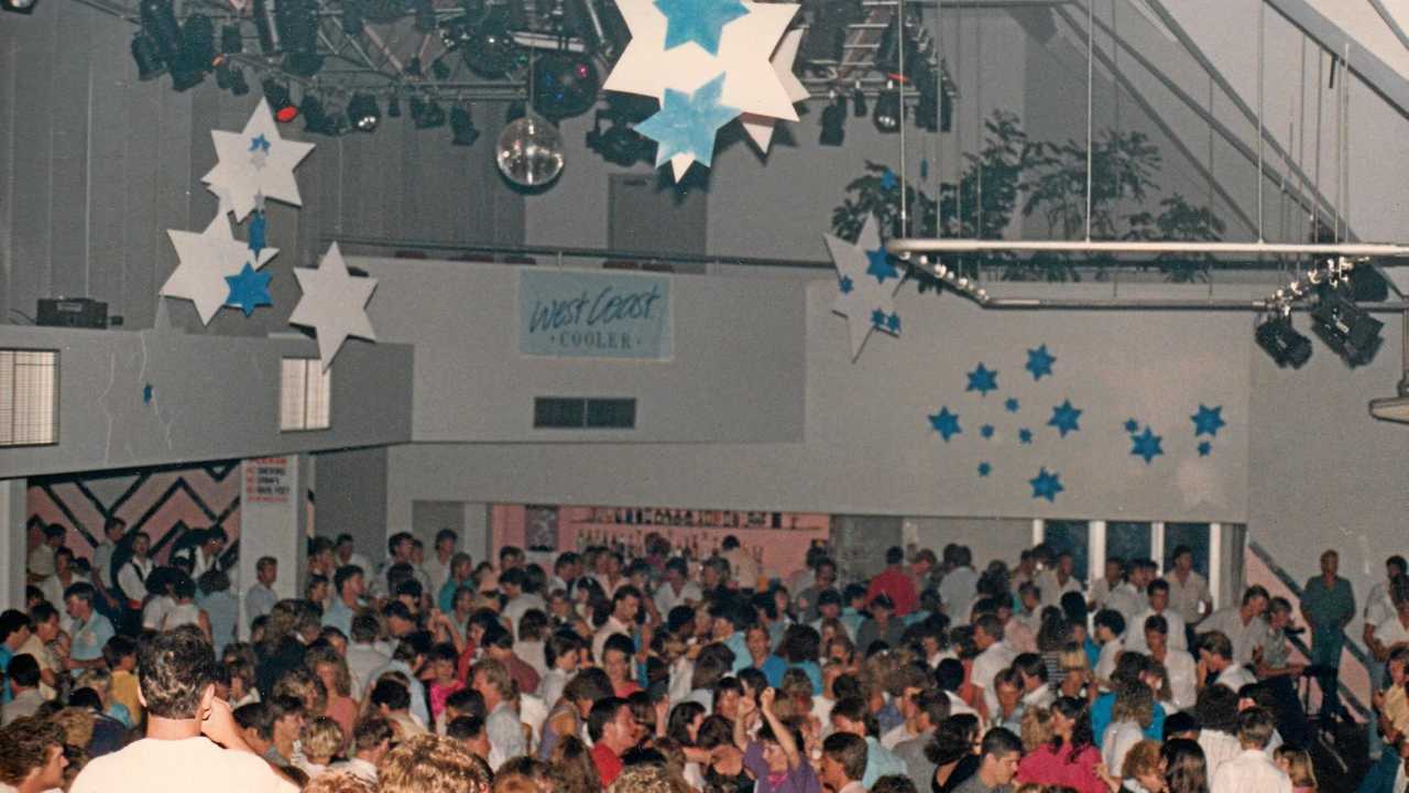
Sunshine Coast - Was 80s Mecca for Nightlife and Live Bands!

 There are no words for how good we had it!  Let's start with this video/pictures courtesy of the Sunshine Coast Daily/Courier Mail and ...